Can you drive the whole Pacific Coast in an RV with small kids and dogs in winter? Yes. In December 2020 we did it in a Class C Winnebago with six people and four dogs. We drove straight up I-5 from Upland, California, to the Olympic Peninsula, turned around at the town limit of Neah Bay, and then followed the coast south through Washington, Oregon and California until we reached the sea lions at La Jolla Cove. Then we drove home.
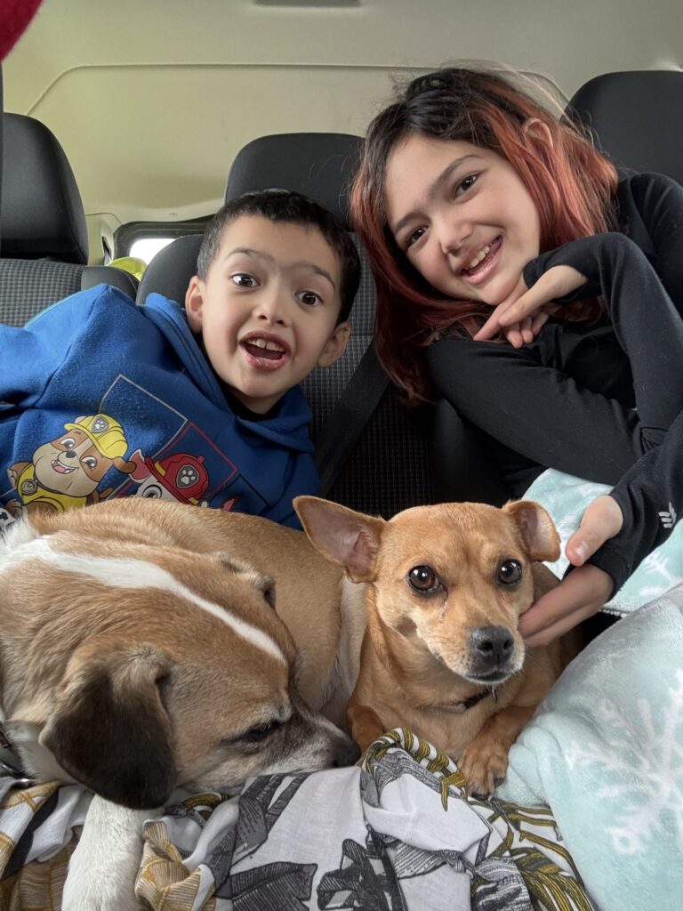
The crew was the two of us, our two kids (a preschooler and a toddler at the time), the kids’ grandmother, our nephew, and four dogs: Grandma’s dogs Oscar and Claudine, River, and our late Kuma. We slept on public land and in lots and pull-offs, not in campgrounds. State parks and roadside attractions were our day stops.
This is the trip report, leg by leg in route order. Some stops have their own posts, linked below. If you want the practical side of sleeping in an RV with kids and dogs, read our guide to RV camping with kids and dogs.

The route at a glance
We drove the trip in two halves. The first half was fast: Upland to the Olympic Peninsula on I-5 in two to three days. The second half was slow. From the northwest tip of Washington we followed the coast roads south, mostly on US 101 and then California’s Highway 1, stopping wherever the kids could get out and move.
In route order, the main stops were:
- Washington: Neah Bay town limit, Olympic Peninsula beaches, Olympic Game Farm near Sequim, the Long Beach Peninsula and Marsh’s Free Museum, Cape Disappointment
- North Oregon coast: Sunset Beach near Warrenton, the Peter Iredale shipwreck at Fort Stevens, Nehalem Bay, Rockaway Beach, Tillamook Creamery
- Christmas: with family near Portland
- Central and south Oregon coast: Yachats, Cape Perpetua and Thor’s Well, Heceta Head, Sea Lion Caves, the Oregon Dunes near Florence, Bandon, Arch Rock and the Samuel H. Boardman corridor, Brookings
- California redwood coast: Crescent City, a redwood trail nearby, Trees of Mystery, Prairie Creek elk, Ferndale, the Avenue of the Giants, the drive-through trees, Confusion Hill, Westport, Fort Bragg
- Sonoma to San Diego: Goat Rock and Bodega Bay, Point Reyes Lighthouse, Mount Tamalpais, the Golden Gate Bridge and the Presidio, Año Nuevo, Big Sur, the Piedras Blancas elephant seals, the Central Coast, La Jolla Cove
Upland to the Olympic Peninsula on I-5
We did not try to see anything on the way north. The plan was to get to the top of the map, then take our time coming back down the coast. I-5 is the fastest line from Southern California to Washington, and with an RV full of kids and dogs, two to three days of driving was enough.
That choice shaped the whole trip. Driving the coast only once, southbound, meant the coastal stops came in order.
Neah Bay and the Olympic Peninsula
Our goal was Cape Flattery, the northwestern tip of the lower 48 states. The road there runs through Neah Bay, the last town before the cape, on the Makah Reservation. We reached the town limit and could not go in. The Makah Tribe had closed its lands to visitors in March 2020 to protect the community during the COVID-19 pandemic, and the closure lasted about two years. So we turned around at the town limit.
If you go now, the cape trail and the beaches are reached on Makah land. As of 2026, the tribe requires a Makah Recreation Permit, $20 per vehicle and valid for the calendar year, displayed in your windshield. Check the tribe’s site for current rules before you drive out.
From Neah Bay we hugged the coast on the way back east and south, stopping at beaches along the way. On December 21 we drove through Olympic Game Farm near Sequim, where elk walked right up to the car.
The Olympic Peninsula is wet in winter. The National Park Service says most of the coast’s 100 to 170 inches of yearly rain falls between November and April, and that storms can close roads. Plan a buffer day.
The Long Beach Peninsula and Cape Disappointment
Before crossing into Oregon we stopped on the Long Beach Peninsula in southwest Washington. Marsh’s Free Museum in Long Beach is the kind of odd local museum that kids remember, and its most famous resident is Jake the Alligator Man. At the mouth of the Columbia River we visited Cape Disappointment and its lighthouse.
Sunset Beach, Fort Stevens and the north Oregon coast
On December 22 we crossed the Columbia into Oregon and drove the motorhome onto the sand at Sunset Beach, south of Warrenton. The kids slid down the grey dunes, and a dog ran on the beach at sunset. We spent the evening parked on the sand.
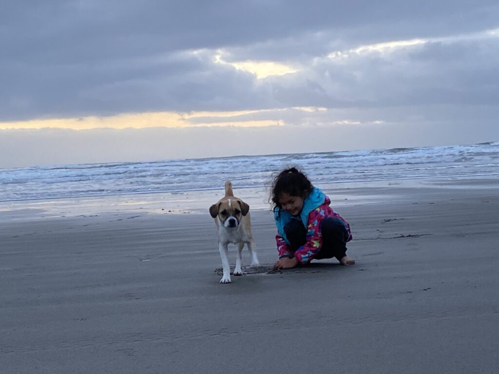
Two rules matter here. First, beach driving is legal on this stretch, but only in some places and times. As of 2026, Fort Stevens State Park says street-legal vehicles may drive the ocean shore from Gearhart to the South Jetty. Driving is banned from the Peter Iredale access to the South Jetty from noon to midnight, May 1 to September 15. Four-wheel drive is strongly recommended. Second, you cannot camp there. Oregon’s rules have prohibited camping on the ocean shore between the Necanicum River and the Columbia’s South Jetty since 1999. That includes parking a vehicle in a way that lets you stay overnight. If you drive onto Sunset Beach, treat it as a day or evening stop and leave before night.
The same day we walked out to the wreck of the Peter Iredale at Fort Stevens State Park. Note that since October 1, 2025, all day-use areas at Fort Stevens require a parking permit.
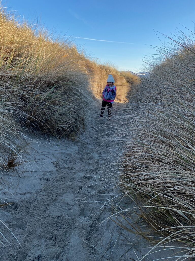
On December 23 we moved south to Nehalem Bay. We walked the dune grass paths at Rockaway Beach and stopped at the Tillamook Creamery, the big cheese factory on US 101. We cover this whole stretch, with beach driving and dune notes, in our north Oregon coast with kids post.
Christmas near Portland
We left the coast for Christmas Day with family near Portland, then drove back to the ocean.
Central Oregon: yachats to Florence
December 26 was one of the fullest days of the trip. The RV spent time at a pull-off in Yachats, and from there the stops came fast. At Cape Perpetua we saw Thor’s Well, the hole in the rock shelf where the ocean drains and surges. Heceta Head and its lighthouse came next, then Sea Lion Caves, and then the Oregon Dunes near Florence.
This is a short piece of coast with a lot packed in. With kids, it works best as a slow day with many short stops rather than long hikes. We plan to give Cape Perpetua to Florence its own post later.
South Oregon coast: Bandon to Brookings
South of Florence we stopped for the sea stacks at Bandon, then Arch Rock and the Samuel H. Boardman corridor, a run of viewpoints and short trails above the ocean. On the morning of December 27 we walked a beach with sea stacks in Brookings, the last Oregon town before California. The south Oregon coast will also get its own post later.

Crescent City, the redwoods and trees of mystery
On December 27 we passed the Welcome to California sign and stopped in Crescent City, where we watched harbor seals resting. We walked a redwood trail with wooden stairs near town. Then we drove south to Trees of Mystery in Klamath. The kids saw the giant Paul Bunyan and Babe the Blue Ox and walked the Trail of Tall Tales. We skipped the gondola.

Farther south, around Prairie Creek and the Fern Canyon area, we saw elk by the road. Then we went on to Ferndale, a small town with a Victorian main street.
RV drivers need to know the road rules in this area. As of 2026, the National Park Service lists several scenic drives in Redwood National and State Parks that do not suit motorhomes. Howland Hill Road near Crescent City will not fit motorhomes, RVs or trailers. Davison Road to Fern Canyon allows RVs only up to 24 feet and no trailers. The Newton B. Drury Scenic Parkway through Prairie Creek has no RV limit listed. Our full stop guide is Crescent City and the redwoods with kids.

Avenue of the Giants and the drive-through trees
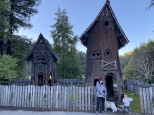
December 28 was redwood day. We drove the Avenue of the Giants, the old highway that runs beside US 101 through Humboldt Redwoods State Park, and walked one of the groves. We parked the motorhome right under the towering redwoods. In Miranda we stopped at a redwood tree house attraction, and near Redway the kids walked through hollow redwood trunks.
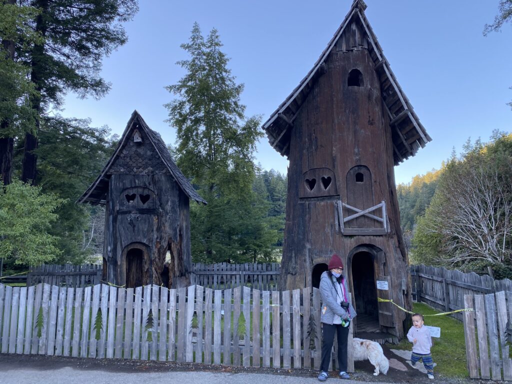
The drive-through trees are a classic on this stretch. Our Class C does not fit through them, so we stopped, parked and let the kids walk through instead. We passed the Chandelier Tree sign in Leggett. Just north of there, Confusion Hill near Piercy has a gravity house, a tilted building where your sense of balance stops working.
That night we stopped at Westport on the Mendocino coast, with the moon over the RV. On the way south we stopped on the bluffs at Fort Bragg. Everything on this leg is in our Avenue of the Giants with kids post.
Sonoma, Point Reyes and San Francisco
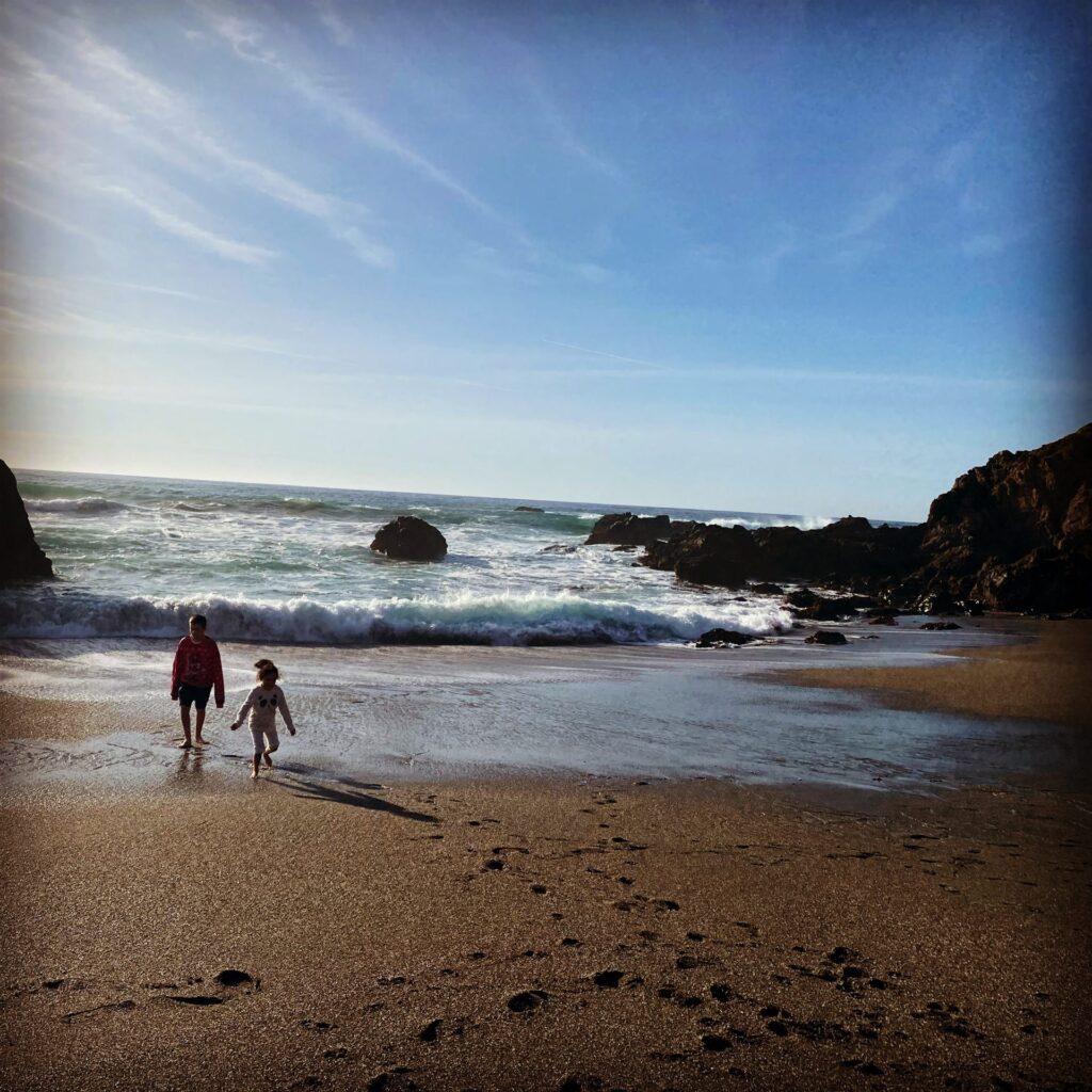
From December 29 we were on the Sonoma coast. We stopped at Goat Rock, where the Russian River meets the ocean, and the kids played on a cove beach at Bodega Bay. Goat Rock is also a climbing spot we know from another trip; see our Goat Rock climbing guide.
Next came the long drive out to Point Reyes Lighthouse. It is a real commitment. The National Park Service says the lighthouse lot is about 20 miles and 45 minutes each way from the Bear Valley and Point Reyes Station area. As of 2026, RVs and trailers cannot park in the lighthouse lot and must park along the road, and overnight RV parking is prohibited throughout the seashore. The lighthouse sits 313 steps below the visitor center, and the stairs close in winds above 40 mph. Pets are not allowed beyond the parking lot area.
Then we drove up Mount Tamalpais, crossed the Golden Gate Bridge and stopped at the Presidio in San Francisco. We plan a separate post on Point Reyes and the Golden Gate.
Año Nuevo, Big Sur and the elephant seals
South of San Francisco we stopped at Año Nuevo State Park to see elephant seals. California State Parks says that from December 15 to March 31, you can see the seals there only on a docent-guided walk of about 2.5 hours and 3 to 4 miles, with sand dunes. Plan for it if you visit in winter.
Then came Big Sur. Farther south, beside Highway 1, we stopped at the Piedras Blancas elephant seal rookery. Friends of the Elephant Seal says the viewing area is 7.8 miles north of San Simeon and is free, with no reservation, open sunrise to sunset every day. It is an easy roadside stop with kids. Big Sur and the elephant seals will each get their own write-up later.
The Central Coast to La Jolla cove, and home
We drove the Central Coast south toward Southern California. Our last coastal stop was La Jolla Cove in San Diego, where sea lions and seals lie on the rocks right by the road and the park. Then we drove north and east, home to Upland.
How we did it
The RV and the crew
We traveled in our Class C Winnebago. Six people slept in it: two adults, the two kids, the kids’ grandmother and our nephew. Four dogs rode along. A Class C has the cab-over bed and enough room to cook and sleep without setting anything up outside, which matters when you park in lots.
Four dogs and two small kids in one RV take planning. Our packing list for traveling with a dog covers the gear.
Where we slept
We did not use campgrounds on this trip. We slept on public land (national forest and BLM) where we could find it, and in lots and pull-offs: Walmart lots, casinos, rest areas and beach pull-offs. Each of those has its own rules. Walmart says permission to park is given store by store, based on space and local laws. Casinos set their own policies. Rest area rules are posted by each state. Our guide to RV camping with kids and dogs explains how to find spots and ask permission.
December weather on the coast
We did this trip in December, the heart of the rainy season. The National Park Service says the Olympic coast gets 100 to 170 inches of rain a year, most of it between November and April, with low-elevation temperatures that are cool to mild and occasionally below freezing. Farther south, the NPS says the redwood coast gets 60 to 80 inches a year, mostly from October through April, with coastal temperatures in the mid-40s to low 60s°F. Expect rain gear on most days, storms that can close roads, and short daylight. Keep driving days short so you are parked before dark.
Plan your own Pacific Coast RV trip
Best season
Winter is the wet season on the whole route, as the NPS figures above show. Summer and early fall are drier and give you longer days, but they are also busier. Winter rewards you with quiet roads and wildlife: the elephant seal season at Año Nuevo starts December 15. If you go in winter, plan flexible days and accept that some roads may close.
Driving US 101 and highway 1 in an RV
US 101 is the main road through Washington, Oregon and northern California. Most of it is fine for a Class C. The trouble comes on side roads. In the redwoods, check the NPS road list before you turn off: Howland Hill Road will not fit a motorhome, and Davison Road allows RVs only up to 24 feet. At Point Reyes, RVs park along the road, not in the lighthouse lot.
California’s Highway 1 is slower, with tight curves on the Mendocino, Sonoma and Big Sur coasts. Give yourself extra time, use the pullouts to let traffic pass, and do not count on making the same mileage you would on US 101.
Big Sur closures: check current status
Highway 1 through Big Sur closes often. It reopened fully on January 14, 2026, after years of slide repairs. By February 2026 Caltrans had closed it again near Regent’s Slide, and in late August 2026 a 40-mile stretch closed for wildfire operations. Check Caltrans QuickMap the day you plan to drive it, and have a US 101 detour ready.
Dogs at the parks
Dog rules change from park to park, and most of the big scenic parks limit dogs. In Redwood National and State Parks, as of 2026, dogs are not allowed on trails but may be on beaches, roads, picnic areas and developed campgrounds on a leash no longer than 6 feet. California state parks generally do not allow dogs on trails or on most beaches. Oregon State Parks allows dogs on most ocean beaches but requires a leash no longer than six feet and says never to leave a pet unattended in a vehicle. Plan which adult walks the dogs while the others hike.
Permits and passes
Fort Stevens now requires a day-use parking permit. The Makah Tribe requires its own recreation permit for Cape Flattery and the reservation’s beaches. National park sites on the route accept the federal passes; see our national park pass post for how they work. For more California state park ideas, see our best California state parks post.
More road trips
This was our big coastal trip. For the inland version, through Sequoia, US 395, Yosemite and Lake Tahoe and back down Highway 1, read our California Sierra road trip with kids.
The stops from this trip with their own guides:
- North Oregon coast with kids: Sunset Beach, Fort Stevens, Nehalem Bay and Tillamook
- Crescent City and the redwoods with kids: harbor seals, redwood trails and Trees of Mystery
- Avenue of the Giants with kids: groves, tree houses, drive-through trees and Confusion Hill
- RV camping with kids and dogs: how we park, sleep and keep the dogs safe