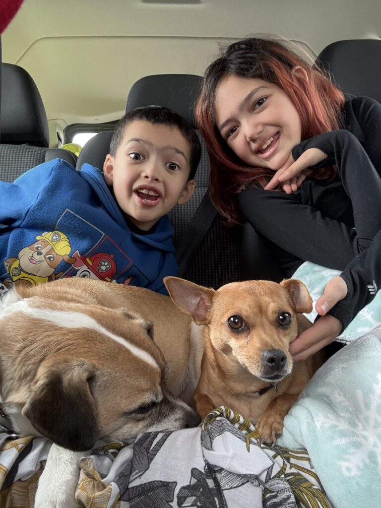
Some road trips are one long drive with a clear start and end. Ours through the Sierra is a loop we keep coming back to. It starts and ends at home in Upland, east of Los Angeles. It climbs into the giant sequoias, runs north up US 395 under the east face of the Sierra, crosses into Yosemite, swings up to Lake Tahoe, and then drops through the back roads of wine country to the Sonoma coast before Highway 1 brings us home. We drive it in our Class C Winnebago with the kids and the dogs, and we sleep on public land, not in campgrounds.
One thing to know before you read on: this is not the diary of a single trip. We have driven this loop, or big pieces of it, several times over the years. Our photos come from summer 2014, from May, October and November 2021, and from May 2022. We drove some legs in spring and others in fall or early winter. So read this as one route built from real legs we have driven, in the order we would recommend to another family.
If you want the short answer first: the full loop works best from late May or June through October, when Tioga Pass through Yosemite is usually open. The kids climbed at five areas along the way, from the Alabama Hills to the Sunset Boulders at Goat Rock. And the east side of the Sierra, along US 395, is where public land camping is easiest. Each big stop also has its own guide, linked as we go.
The shape of the loop
Picture a big oval laid over the middle of California. The bottom of it is home in Upland. From there the route heads north through the Central Valley to Three Rivers and Sequoia National Park. It then crosses to the east side of the range and follows US 395 north past Lone Pine, Bishop, Mammoth Lakes, June Lake, Mono Lake and Bridgeport. From the Eastern Sierra it turns west over the mountains into Yosemite, then north to Lake Tahoe.
After Tahoe the mountains fall away. Back roads take us west toward Calistoga and Mount Saint Helena at the top of the Napa Valley. From there we follow the Russian River down to the ocean at Goat Rock, then turn south on Highway 1 and let the coast carry us home. It is a long way around, but every leg feels different: big trees, high desert, granite valleys, an alpine lake, vineyards and then the Pacific.
We like this direction for a family leaving from Southern California. Sequoia is a manageable first day out. The Eastern Sierra comes early, when everyone still has energy for climbing and camping. And the slow, scenic coast comes last, when nobody wants to set up anything complicated. Our four stop guides go deeper on each section: Sequoia with kids, US 395 and the Eastern Sierra with kids, Yosemite Valley for families and Lake Tahoe with kids.
Leg one: Upland to Sequoia and Three Rivers
The first leg is the easy one. From Upland the road heads north into the Central Valley, and the usual way in is Highway 198 through Visalia to Three Rivers, the small foothill town where the Kaweah River comes out of the mountains. It is the last place for gas before the park, and it makes a natural first stop. Our Sequoia photos are from May 2022.
The giant sequoias are the reason to come, and they are worth the drive. The General Sherman Tree is the largest tree on Earth by volume, and the paved walk to it is short enough for small legs. Standing next to a trunk that wide does something to kids that no picture can. Around the Giant Forest we walked among the big trees while the dogs waited in the RV, since dogs are not allowed on trails in the park.
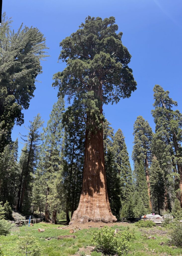
The road up is the part to plan. The Generals Highway climbs from the hot foothills to the Giant Forest on steep switchbacks, and the Park Service advises against long vehicles on the lower section. If your rig is long, read the RV section further down before you drive up from Three Rivers. The foothills are also much hotter than the big trees, often by 20 degrees or more in summer, so do any low walks early and spend the warm part of the day up high.
On the way back down into the valley we stopped in Exeter, a small farm town with more than 30 painted murals on its downtown buildings. The kids posed in front of a train mural, and we stepped into an old-style diner. It is the kind of easy, unplanned stop that breaks up a driving day. Everything about the trees, the trails and the road is in our Sequoia with kids guide.

Leg two: US 395, Lone Pine and the Alabama Hills
From the Sequoia side we cross over to the east side of the Sierra and pick up US 395. It is the best public land stretch of the whole loop. The highway runs north through the Owens Valley with the Sierra rising like a wall on the left. Mount Whitney, the highest peak in the lower 48 states, sits right above the town of Lone Pine. Most of the land on both sides of the road is public, managed by the BLM or the Inyo National Forest, which makes it ideal for a family that likes to camp for free.
Just west of Lone Pine are the Alabama Hills, a jumble of rounded, weathered rocks between the highway and the mountains. In November 2021 we camped near Tuttle Creek, at the south end of the hills, with Whitney above us. The kids climbed on the rock there, and it is a good place to introduce young kids to climbing. Our Alabama Hills climbing guide covers where to go and how we set up.
The camping rules have changed since that trip. As of 2026, the BLM requires a free Alabama Hills permit to camp, and you may only camp at designated sites marked with a tent symbol. The permit is good for a year but does not reserve a spot, so sites are first come, first served. There is no trash service, and solid human waste has to be packed out, which is simple with an RV toilet. The US 395 guide has the full details.
Leg three: Bishop, Mammoth and June Lake
North of Lone Pine the valley opens up and the road runs on to Bishop, the biggest town on this stretch and the best place to restock. West of town, Buttermilk Road climbs to the Buttermilks, a famous bouldering area of huge granite blocks under the high peaks. We camped there but did not climb. For us it was a place to sleep. The area mixes national forest land with private and utility land, and camping is only allowed on the national forest part.
From Bishop the highway climbs steadily toward Mammoth Lakes. Here the land changes. It is volcanic country, with dark rock, cut valleys and creeks that steam in the cold air. We slept at national forest spots around Mammoth and June Lake, where the Inyo National Forest allows dispersed camping unless an area is posted closed. One rule surprises people: in California, you need a free campfire permit for any open flame in dispersed areas, including a camp stove.
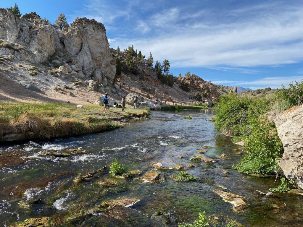
Near Mammoth the kids climbed at Horseshoe Slabs. Slab climbing is good for kids because it teaches them to trust their feet instead of hauling on their arms. Our Horseshoe Slabs guide has the approach and the routes.
The hot springs around Mammoth look inviting, but the best-known one, Hot Creek, is closed to entry. The water temperature can change fast and some springs are hot enough to cause severe burns. With kids, stay on the trail and behind the fences. Just north of Mammoth, the June Lake Loop (Highway 158) makes a short detour past a string of lakes before rejoining 395. It is a pretty drive and an easy place to find a quiet spot for the night.
Leg four: Mono Lake and Bridgeport
Past June Lake, the road drops to Mono Lake, a strange, salty lake with towers of tufa rock standing along the shore. The easiest place to walk among them is South Tufa, on a short self-guided trail. As of 2026 the Forest Service charges a small day-use fee there for adults, kids are free, and leashed dogs are allowed. There is no shade and no water, so bring both.

North of Mono Lake, the road climbs again and then drops into Bridgeport, the northern end of our 395 leg. Just outside town are the travertine terraces of Travertine Hot Springs, on BLM land. The white and yellow-green rock steps down in terraces, with pools and the Sierra behind it. Our photos from there are from May 2021, on a trip when we drove 395 from Bridgeport down to Mammoth. The kids explored the edges of the travertine and the pools.
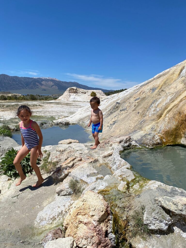
The travertine matters to the local Tribe, and the BLM sometimes closes the site for ceremonial use. Check with the BLM Bishop Field Office before you go and respect any closure. The rock is also fragile, so stay on the paths.
Leg five: Yosemite
From the Eastern Sierra, the classic way west is Tioga Pass on Highway 120. It climbs from Lee Vining near Mono Lake, crosses the crest at nearly 10,000 feet, runs through the granite domes and meadows of Tuolumne, and then drops into Yosemite. It is one of the most beautiful drives in the state. It is also closed for months every year because of snow, so your whole route depends on it. There is more on that in the planning section below.
Our Yosemite photos are from October 2021. The valley in fall is quieter than in summer, the maples turn yellow and red, and the light on the walls is soft. We stopped at Tunnel View for the big first look at El Capitan, Half Dome and Bridalveil Fall. It is a short walk from the parking area and an easy win with tired kids.
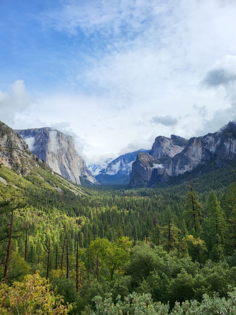
For climbing, the kids went to Swan Slab, a low granite slab right by Camp 4 at the foot of the valley walls. It has plenty of easy routes, though most are trad, so you need the gear and skills or a guide. I also climbed at Sunnyside Bench and up in Tuolumne Meadows. Pets are not allowed on most Yosemite trails, so the dogs stayed in the RV when we walked. They can come along on paved paths like the Lower Yosemite Fall loop.
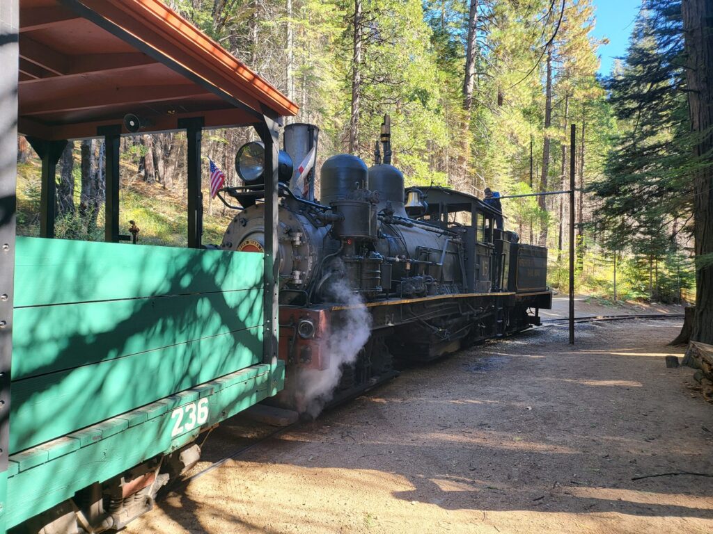
On the same October trip we spent time south of the park around Oakhurst, Coulterville and Fish Camp. At Fish Camp, the Yosemite Mountain Sugar Pine Railroad runs an old steam train through the forest, and leashed dogs are welcome. The kids also explored the big hollow logs in the woods there. Our Yosemite Valley for families guide covers the valley, the walks, the RV parking and the dog rules in depth.
Leg six: Lake Tahoe
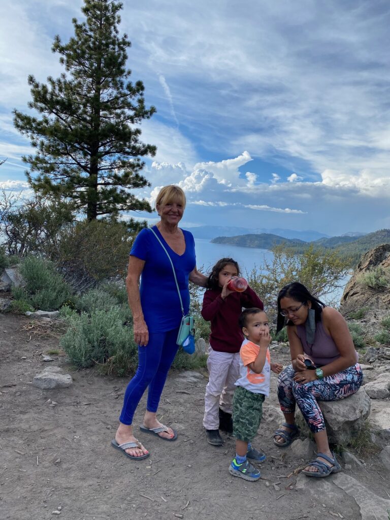
From Yosemite the loop heads north to Lake Tahoe. Our Tahoe photos are from late May 2021 and from summer 2014. In May 2021 we spent time on the south shore and across the state line on the Nevada side, around Glenbrook and Kingsbury. The kids walked the trails on the rocky hillsides above the lake, and we stood on a ridge with pines all around and the water far below. On the west shore, around Tahoe City and Sunnyside, we walked under tall pines.
Tahoe is also climbing country. The kids climbed at Lovers Leap, on Highway 50 southwest of the lake, and at Donner Summit, on Old Highway 40 northwest of it. At Lovers Leap, the smaller formation in front of the main cliff, the Hogsback, has many easier routes. At Donner Summit, School Rock is a low-angle slab with routes named for the grades of school. Both are trad areas.
The view everyone pictures is Emerald Bay, with its small island sitting in the middle of the bay. We saw it from the overlook. RV families should know that the main Vikingsholm lot at Emerald Bay does not take vehicles over 18 feet, and parking on Highway 89 there is not allowed.
The other thing to know is where you can sleep. Tahoe is the one big exception on this loop. Dispersed camping, including sleeping in a vehicle, is banned on national forest land in the Tahoe Basin. So around the lake, plan on a campground, or sleep outside the basin. Our Lake Tahoe with kids guide has the crags, beaches, dog rules and camping options.
Leg seven: back roads to Mount Saint Helena
After Tahoe we leave the high mountains and cross west toward wine country. The pines give way to oak hills and then to vineyards. Mount Saint Helena rises above Calistoga at the top of the Napa Valley. The mountain is part of Robert Louis Stevenson State Park, and its parking area is on Highway 29 between Calistoga and Middletown.
The mountain has volcanic rock and a small local climbing scene. I top-roped a formation known as the Bubble. The kids did not climb it, but they swung on the rope at its base.
Leg eight: down the Russian River to Goat Rock
From the hills above Calistoga we follow the Russian River down toward the ocean. The river winds through redwoods and small towns before it meets the Pacific at Jenner. Goat Rock sits near the river mouth in Sonoma Coast State Park.
Goat Rock was one of our climbing stops, and the kids climbed at the Sunset Boulders. It is a good place to end the climbing part of the trip, with the ocean right there. Our Goat Rock climbing guide has the details. If you have dogs, note that California State Parks does not allow them on Goat Rock Beach because of the seals. Leashed dogs are allowed on Blind Beach, off the south parking lot.
Goat Rock is also on our other big trip, the December 2020 drive down the whole West Coast. If you want the ocean side of California in more depth, read our Pacific Coast RV road trip with kids.
Leg nine: highway 1 home
The last leg is Highway 1 south toward Los Angeles. After the mountains, the coast is a change of pace. It is also slow, curvy driving, especially through Big Sur, where the road hangs on cliffs above the ocean. Give it more time than the map suggests, use the pullouts to let traffic by, and check for closures before you commit, because Big Sur closes often after slides.
Back home, we closed the loop with fishing at Cucamonga-Guasti Regional Park, a San Bernardino County park close to Upland. After a long trip, it is a gentle way to finish: no packing, no driving, just a lake and a line. And if you are passing through Orange County on the way, Crystal Cove’s tidepools were the kids’ favorite California stop of all.
Where we slept
We do not use campgrounds on this loop if we can help it. We park and sleep on public land: BLM land on the east side of the Sierra and national forest land in the mountains. On 395 that meant the Alabama Hills near Tuttle Creek, the Buttermilks near Bishop, and national forest spots around Mammoth and June Lake, plus other public land along the way.
US 395 makes this easy because so much of the land along it is open to camping. The rest of the loop is harder. Yosemite does not allow sleeping in a vehicle outside a campground, the Tahoe Basin bans dispersed camping, and the coast is mostly park land with strict overnight rules. For those legs, plan your nights before you arrive, and look for national forest land outside the parks.
Each area has its own rules: permits in the Alabama Hills, stay limits on BLM land, campfire permits in California national forests, and closures that change with the fire season. Whatever the rules, we pack out everything and leave each spot the way we found it. Our Leave No Trace guide for climbing families covers the habits we teach the kids. For how we run the RV day to day with kids and dogs, see RV camping with kids and dogs.
Where the kids climbed
This is a climbing family’s loop, and the kids climbed at five areas along the way. In the Alabama Hills near Lone Pine, they climbed on rounded granite with Mount Whitney behind them (guide). Near Mammoth, they learned slab footwork at Horseshoe Slabs (guide). In Yosemite Valley, they climbed at Swan Slab, right at the base of the big walls. At Lake Tahoe, they climbed at Lovers Leap and Donner Summit. And on the coast, they finished at the Sunset Boulders at Goat Rock (guide).
At Mount Saint Helena they swung on the rope while I climbed. If you want to bring your own kids to these areas, start with what to pack for a family crag day and our list of kid-friendly climbing areas in the USA.
Plan your own California loop
The order and how long it takes
We go counterclockwise: Sequoia first, then north on 395, west to Yosemite, up to Tahoe and down the coast. That puts the high Sierra in the middle of the trip, when you are most likely to be past late spring snow on Tioga. It also ends on the coast, where the driving is slow but easy and nobody has to set up camp in the cold.
The loop has no fixed length. We have done it in pieces over several years. If you want to do it all at once, think in legs. Sequoia, the 395 stretch from Lone Pine to Bridgeport, Yosemite, Tahoe and the coast home are each worth a few days on their own. Driving days with kids are shorter than you think, so plan fewer miles per day than you would on an adult trip, and leave a spare day or two for weather or tired kids.
Tioga Pass and the other Sierra passes
Tioga Road, Highway 120 through Yosemite, is the link between the Eastern Sierra and the park, and it closes every winter. The Park Service says it is typically open from late May or June until sometime in November. In 2026 it opened on May 15. Overnight parking on Tioga Road is not allowed from October 15 until it reopens in spring. Check the page before you go, because your whole route depends on it.
If Tioga is closed, the other roads over the Sierra north of Yosemite are Sonora Pass (Highway 108), Ebbetts Pass (Highway 4) and Monitor Pass (Highway 89). They close for winter too. According to Caltrans District 10, crews usually start clearing snow in early April and aim to reopen before Memorial Day. In 2026, Monitor Pass reopened on March 5, Sonora Pass on April 30 and Ebbetts Pass on May 6. All three are high, steep and winding. In a big RV, read up on each one and check Caltrans QuickMap before you go.
Yosemite entry rules
Yosemite’s entry rules change from year to year. For 2026, the National Park Service announced that Yosemite would not require advance reservations and would manage traffic in real time instead. Check the park’s site for the current year before you plan. Since this loop passes through several national parks, an annual pass can pay for itself quickly. Our post on the national park pass explains the options.
RV length limits on key roads
This is the part that catches RV families. In Sequoia, the Park Service advises against vehicles over 24 feet on the Generals Highway between the Foothills Visitor Center and Potwisha Campground, and over 22 feet from Potwisha up to the Giant Forest Museum. Highway 180, through the Kings Canyon entrance, is the preferred route for longer rigs. Crystal Cave Road and the road to Moro Rock and Crescent Meadow have their own 22-foot limits, and RVs are not advised on Mineral King Road. Our Class C is 23 to 24 feet, so check these numbers against your own rig, measured bumper to bumper.
Yosemite is easier. The park’s vehicle restrictions page allows single vehicles up to 45 feet on the main entrance roads, Highways 41, 120 and 140. The side roads are tighter: Hetch Hetchy Road is limited to 25 feet, Glacier Point Road to 30 feet past the Sentinel Dome trailhead, and Mariposa Grove Road to 21 feet. On US 395 itself the driving is easy, but the side roads up into the mountains vary a lot, so look before you commit.
Highway 1 through Big Sur
Highway 1 through Big Sur has a long history of closures after landslides. On January 14, 2026, Caltrans reopened it at Regent’s Slide, restoring through travel between Carmel and Cambria. It closed again in February 2026, and for wildfire operations in late August 2026. Check QuickMap the day you plan to drive it, and know your US 101 detour.
Best months
For the full loop, late May or June through October is the window, because that is when Tioga and the high country are usually open. Our own trips were in May, October and November, plus one summer, and each season changed the route. In late May, the passes may only just be open, and snow lingers up high. In October, Yosemite has fall color, but the high country is close to closing. In November, the Alabama Hills and the low parts of 395 are still great for camping, but plan on Tioga being closed. Sequoia’s foothills and the coast work in more months than the high Sierra does.
Traveling with dogs
We travel with dogs, and the national parks are hard on them. In Yosemite, the pet rules allow dogs on paved roads, sidewalks and paved paths, but not on trails, meadows or beaches. Sequoia is stricter still, with no dogs on any trail, paved or not. So on park days our dogs stayed in the RV while we walked, which only works in mild weather and for short walks. The public land along 395 is much easier on dogs, and national forest trails generally allow them on a leash. Our post on what to pack when traveling with a dog covers our kit.
Keep reading
This loop has four stop guides, one for each big piece of the trip. Sequoia with kids covers the giant trees, Three Rivers and the road up. US 395 and the Eastern Sierra with kids covers the Alabama Hills, Bishop, Mammoth, Mono Lake, Bridgeport and the public land rules. Yosemite Valley for families covers the valley, Swan Slab and the easy walks. And Lake Tahoe with kids covers the crags, beaches and trails around the lake.
If this loop is not enough California, our Pacific Coast RV road trip with kids follows the whole West Coast from Washington to San Diego.